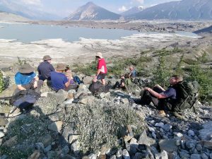
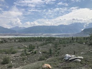
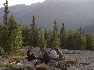
The Yukon – A land of never-ending mountains, endless forests and swarms of mosquitoes.
The above statement sums up how the twenty-one participants on Ex DRAGON MAPLE will remember much of the Yukon. The journey from Whitehorse to the base location at Kluane Lake took two and three-quarter hours but the Alaska Highway seemed to go on for ever through unbroken forest. It was only when we reached Haines Junction did mountains with snow appear; together with the mosquitoes which multiplied in number as we reached base camp.
Background
With the last of the military support to the NHS departing early in the summer of 2021 life at HQ West Midlands suddenly went from very busy to very quiet. With the new found spare time a proposal was bounced off Cliff Peram at ATGA to run an adventurous training exercise to the Yukon for twelve people and a support person. “It’s not to be a holiday” came back the reply. So began almost twelve months of planning interspersed with several more UK resilience ops to make sure it wasn’t straightforward.
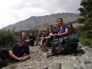
A business plan was put together and a poster circulated for a trekking and canoeing expedition to the Kluane National Park region of the Yukon. Numbers ultimately grew to twenty-one as significantly more people expressed an interest than expected, and two extra instructors were recruited to enable more people to participate. A further rewrite of the business case was approved and an enlarged expedition involving seventeen soldiers from thirty seven signal regiment, together with two from two signal regiment and two from sixteen signal regiment formed the final twenty-one expedition members.
Advance Party Preparations
An advance party of three arrived in Whitehorse in the early hours of the 23rd June, not that this was obvious from looking at the sky as it seemed more like late evening. After a few hours’ sleep at Beez Kneez Bakpakers the first stop was the canoe outfitters to pick up the dehydrated rations and to finalise drop-off and collection points for the canoes. Even though we had arranged to meet the outfitters on the 23rd we were met with a sign on the door to say everybody was away with the Yukon River Race and wouldn’t be back till the 27th June. Despite this initial set-back we set to buying snack bars and packs of nuts for everybody so they had something to eat during the day while they were out on the activities.
After a two and three-quarter hour drive we arrived at Kluane Lake Research Station in the early evening and were met by Harry the station manager. The station is situated on the southern shore of Kluane Lake and looks out onto Sheep Mountain on the western side and the Ruby Range running down the East side. An unexpected bonus was the provision of the old mess hall for us to use as an administration area. It proved invaluable for dividing up all the boxes of biscuits and putting beverage packs together.
Having brought all the tents out with us the first task of the second day was to get them all set up before visiting the Thechàl Dhâl Visitor Centre to register our mountaineering route in Kluane National Park. The level of detail required came as a bit of a surprise, with the need to supply rucksack and tent colours for the group. This was going to be a little more involved than expected as the majority of the rucksacks were still in the UK with the main group, who hadn’t been issued them yet. Our third priority was to travel a third of the way back to Whitehorse to visit Haines Junction to arrange a presentation at the Canada Parks Service centre for everybody to become bear aware. We also found the Village Bakery, which did a great seafood chowder for late lunch.
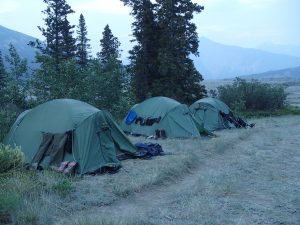
The 25th June brought a return trip to Whitehorse to collect the last hire vehicle and to await the arrival of the main party that night. Having set off early SSgt John Phillips was treated to the sight of a female grizzly and three cubs digging for roots alongside the Alaska Highway. While inspecting the tents the two remaining members of the advance party found one had been visited by a curious bear in the night, which had ripped the flysheet with its paw. Fortunately, we had a spare and after discussions with the parks service it was decided that once people were staying in the tents the bear wouldn’t visit again.
Days 2-3
The 26th June started with a few heat illness and cold injury briefs and instruction on how to use the multi-fuel cookers. In the afternoon we made our way to the Parks Service Centre at Haines Junction to get an introduction to the area and to watch a couple of films on bears and the correct course of action if you meet one. On the 27th WO2 Lindsey Payton and SSgt Tim Abbott set off on another trip to Whitehorse to collect the missing dehydrated rations and to finalise the arrangements with the canoe outfitters. The remainder of us set off on a 16km day trek up Sheep Creek Trail to get a view down the Slims River Valley. The heat and humidity came as a surprise to most of the participants and with temperatures in the mid-twenties it was certainly a lot hotter than the long-term average for the time of year. Several people found the conditions a little too much and turned around at just over half way. After everybody had safely returned to the research centre in the early evening Lindsey and Tim returned from Whitehorse with mountains of boxes of rations, and a revised canoeing itinerary. We had quickly become aware that getting anywhere in the Yukon involved road journeys which seemed to take forever and with limited numbers of drivers the canoeing was moved from Lake Tagish, which is south of Whitehorse, to Kluane Lake which we were camped alongside. Tim was happy he had more than enough lake for five days of canoeing without having to travel for over three hours first, which was a relief.
Trekking Days 4-8
After finally getting and sorting the rations the prior evening both groups now set for their next five days. WO2 Lindsey Payton and SSgt Tim Abbott were going to introduce their group of eight novices to canoeing before embarking on a five-day exploration of Kluane Lake. SSgt John Phillips and LCpl Kiel Vaughan were taking the other eight up the Slims River West trail to reach the Kaskawulsh Glacier while WO2 Cath Smith remained at the research station to provide a reach-back contact and to deal with any logistics needs which arose.
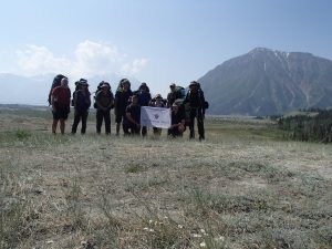
After giving the Thechàl Dhâl Visitor Centre details of tent and rucksack colours and our intended route we set off into the Canadian wilderness. As the centre didn’t open till ten, we arrived at Bullion Creek in the early afternoon when it was running at its highest and completely uncrossable. We met a Canadian couple who had been stranded the previous evening and had been benighted by the creek. So began a two-hour detour through thick forest down to the river delta, to cross where the creek braided and became shallower. The water was running grey from all the silt being brought down by the melting snow and the Katadyn water filter needed constant cleaning during the five days, due to silt blocking the microtubes. We finally arrived at an alluvial fan at just beyond the thirteen-kilometre point in the late evening and set up camp. The final couple of hours had been spent taking turns to carry one of the participants rucksack after they had started to struggle with the terrain and distance, which had slowed the group’s pace to a crawl. As dusk arrived a bear and cub passed a hundred meters above the campsite travelling in the same direction we were heading. We didn’t see them again but it was proof we were in bear country.
Day five saw us finally arrive in the early evening at the basic campsite at Canada Creek. In front of us rising to 2,114m was Observation Mountain with the alluvial fan of Canada Creek spread out for over a mile between us and our objective. The mosquitoes came out in force at this location and the only respite seemed to come when wearing a waterproof jacket with the hood up. Along with mosquitoes the other issue with this location was the shortage of water. The actual creek ran the other side of the delta and it was only after much hunting that Sgt Ash Jordan finally chanced upon a very small slow running stream several hundred meters from the campsite. The high risk of giardia from this source meant that all water had to be meticulously boiled or passed through the failing Katadyn filter. For the next couple of days, the shortage of sufficient water was a constant concern. The other issue which had become apparent was that some of the group were going to struggle with getting to the top of Observation Mountain, and after meeting two French Canadians at the campsite who had twice failed to find the route up one of the ridges to the summit the initial expedition objective was shelved.
After looking at our issued twenty-five-year-old Canadian Geographic Service maps an alternative plan was devised to cross Canada Creek and traverse around the eastern side of Observation Mountain to a large moraine which jutted out above the glacier. While this wasn’t going to get us a view deep into the icefield it would give us a view up the glacier. Day six finally saw us cross Canada Creek in the early afternoon. It had numerous braids and crossing necessitated going up and down these to find safe points where the water wasn’t too deep or fast. The limitations of using a twenty-five-year-old map with a 40-meter contour interval soon became apparent. There was a lot of ground detail which was not present on the map and all the other creeks marked on the map had long since dried up. After an afternoon of going up and down moraines we arrived at Slims Lake which had been formed when the glacier had receded in 2016. The toe of the glacier lay in front of us and a clear view of the final moraine came into sight. We carried on until 18:00 when a deep ravine appeared. We were going to need to descend down into this before climbing out again. We had been trekking for over five hours and the summit of the final moraine was still at least an hour and a half away, with a thick covering of dwarf willow to thrash through to get there. The only redeeming feature of this ravine was that it contained fast running clear water which was desperately need as nobody had been able to replenish any of their water bottles during the day. After refilling anything which could carry water the decision was made to turn around. To carry on would have meant a return to the campsite in the early morning and several of the group had found the day challenging. We got back to the campsite late in the evening and after cooking an evening meal finally got to bed around midnight.
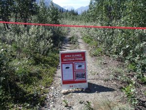
It is much easier finding a trail on the return journey. The markers we had missed on the journey in were obvious on the way out. The end of day seven found us back at the campsite on the alluvial fan at around the thirteen-kilometre point. Day eight started early with reveille at 05:00 with camp crashed and us on our way by 06:20. The aim was to be at Bullion Creek mid-morning to avoid having to make a detour through the forest. We arrived at the creek to find it lower than on the way in and after carefully fording it were finally on our way back to the start point. Arriving back at the Sheep Creek Trail junction we were met by tape across the track and a sign closing entry to the west side of Slims River. There had been too many bear sightings reported and the parks service had closed further access to this area of the park. There was no plan for not being able to trek to the Kaskawulsh Glacier by an alternative route, and the bear factor had not been considered when filing routes in the UK.
Canoeing Days 4-8
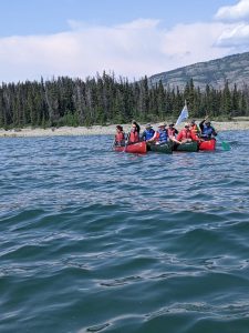
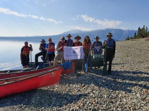
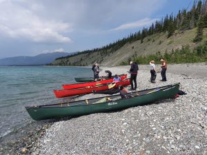
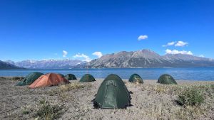
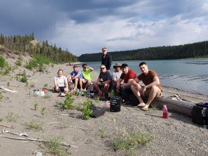
Day four found the canoeing group carrying out capsize drills, individual (self) rescues and group rescues in the chilly waters of Kluane Lake. Until recently the lake had been fed by the Kaskawulsh Glacier and even in mid-summer the water temperature was still in single figures. The group started their paddling into a headwind and managed to achieve 10 kilometres in three hours without incident. The group passed the remains of Silver City, an abandoned trading post, in the late afternoon before setting up camp on a beach 2 kilometres west of the settlement.
Over days five and six the canoeing group made their way up the eastern side of the lake to a small spur at the southern entrance to Talbot Arm. Along the way the group met some fishermen on the lake who gave them one of their catch, which provided a welcome break from dehydrated rations. Hoping to canoe across the lake to Destruction Bay on the western shore the group set off in the afternoon of the sixth day but the weather turned and with the wind and waves picking up the group turned around and made their way back to the eastern shore. After paddling back to the eastern shore, the group set up camp on the spur for the evening. Days seven and eight found the paddlers with the wind behind them and a journey back along the shore which they had travelled previously.
Changeover
Without the services of both assistant trekking instructors for the second rotation of trekking we had to find something constructive to do for two participants who had been canoeing in the first group. Unfortunately, group instructor to student ratios now limited the numbers who could go trekking. Cpl Steve Morgan and LCpl Greg Hardy volunteered to remain at the research station and after discussions with Harry several jobs were found to keep them busy while other participants were out on activities. Over the next five days the station gained a refurbished accommodation hut and one of the water supply pipes was buried underground to protect it from freezing in the winter. With LCpl Kazam not having managed to pass his military swim test before we arrived a job was found helping out cooking for the station staff and other visitors. His military chef talents definitely produced a great end of expedition barbeque for everybody at the station.
Trekking Days 9-13
With the west trail up the side of the Slims River still closed due to bear sightings a route was filed at Thechàl Dhâl Visitor Centre to follow the route up the east side of the Slims River. A trail is maintained by the parks service while a route is not maintained. The difference on day nine soon became obvious as once we had got to the end of the trailhead road, we couldn’t find a path. Wet feet were yet again the order of the day as we crossed Vulcan Creek. SSgt John Phillips also manged to end up in a patch of quick mud after taking a slightly different route at one of the crossings and a few nervous seconds were spent getting out of it. The Slims River is named after a horse called Slim which drowned when it fell into one of the patches of quick mud in the river flats.
After getting across Vulcan Creek alluvial fan we spotted a piece of tape in a tree which took us onto the old trail. Despite having to make detours for fallen trees we managed to stick to the path and in the late afternoon got to a second alluvial fan for an unnamed creek. There were quite a few trees on this fan and after crossing we spent an unsuccessful hour trying to find a route through the forest on the far side. After returning to our start point on the fan we met two Spaniards also looking to follow the east route up the Slims River. We combined our efforts and for the next two and a half hours found various pieces of tape which took us into the forest. After following what looked like promising starts all routes ended with hitting impenetrable thickets of new growth or piles of fallen trees. Rather dejectedly we returned to the fan at nine in the evening and put the tents up on a bluff overlooking the creek and then sat down to cook something to eat by the creek.
With no obvious route up the east side of the Slims River and no machete to help force a route through the decision was taken on day ten to return to the research station to come up with an alternative plan for the remaining three days. Again, finding the route back proved easier than finding it on the way out and fortunately the actual path crossed Vulcan Creek above the mud and marshes in the river delta. With all the trekkers back at the research station at the end of day ten a plan was made to complete Sheep Mountain ridge on day eleven.
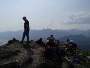
Day eleven found us on Sheep Creek Trail again, except when we got to the view point at the end, we turned east up the ridge at the western end of Sheep Mountain. The ascent was steady if steep in places. Frequent rest stops kept everybody together as the ascent for the day was the equivalent of going up Ben Nevis, expect there were no tourists on this mountain. As we got higher the views down the Slims River to the icefield around Mount Logan opened up as did views across to the icefield on Mount Vulcan to the south. We arrived on the ridge in the afternoon and the sat phone showed we had reached an altitude of 1,845m on the eastern peak of the ridge. Only 77m below the height of Sheep Mountain itself. With the summit of Sheep Mountain still several hours away along the ridge and with the high humidity resulting in some people drinking more water than they had envisaged a decision was made that the eastern summit was as far as we would be going, and the descent would be back the way we had come up. There had been no opportunity to refill water bottles on the way up and the nearest water source available (if committing to completing the ridge) would have been down at Kluane Lake after completing and descending down off the ridge.
Day eleven had allowed a recce from a distance of the proposed overnight route for days twelve and thirteen up Bullion Creek trail onto the plateau below Red Castle Ridge. Even from a distance off Sheep Mountain Ridge the final section looked very demanding with a lot of route-finding, and an ascent of 300m through what looked like thick dwarf willow. The staff at Thechàl Dhâl Visitor Centre had suggested an alternative overnight trek outside the park up Bock’s Creek to Bock’s Lake. The alternative route looked to provide a more valuable experience for participants and Bock’s Creek was the destination for day twelve.
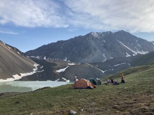
After breakfast on day twelve at the Talbot Arm Motel in Destruction Bay we parked up on the berm near the end of Bock’s Creek. The Canadian version of an English breakfast seemed to be missing sausages, beans and even mushrooms. It did come with lots of toast and endless coffee though. The route up Bock’s Creek followed the course of the watercourse fairly closely and was easy to find. As the day progressed, we steadily gained height and Kluane Lake disappeared from view and the mountains rose around us, with patches of snow lying in shaded spots. After 10 kilometres we reached Bock’s Lake at an altitude of 1,900 metres at the head of the creek. The lake was partially covered in ice and one of the surrounding mountains sounded alive, with frequent rock falls during our stay. Waking up at 05:00 on day thirteen we found the ice had almost covered the lake and there was a thin layer of frozen dew on the rucksacks. The cold was a welcome relief from mosquitoes and as we set off on the return journey at 06:30 the rising sun quickly warmed the air up. Arriving back at the research station in the early afternoon we found the canoeists already there cleaning and sorting equipment.
Canoeing Days 9-13
The canoeists spent the first part of day nine practising their capsize drills before setting off along the western shore of Kluane Lake to camp at Cottonwood campground on the first night. On day ten they made it to the settlement of Destruction Bay where they stocked up on treats from the one shop in the settlement. In the evening to get back to the wilderness the group paddled the 5 kilometres across the lake to camp on the eastern shore. Day ten had been a big paddle with nearly thirty kilometres covered and camp not being set up until almost midnight. The eleventh day brought a later start and a continuation of the exploration of the eastern shore with a paddle into Talbot Arm before turning round to travel back south.
Day twelve found a favourable wind help the group make their way back down the shore to Cultus Bay where camp was set up in the shadow of The Ruby Mountain Range. The evening breeze down the lake was a welcome relief as it kept the mosquitoes at bay. An early start and a following breeze on day thirteen enabled the group to make the last 14 kilometres back to the research station at record speed.
With everybody back at the research station by the afternoon of day thirteen and a big team effort to clean cookers, cooking sets and the fuel bottles we were set for the barbeque in the evening. LCpl Kazam produced a big spread for all the expedition participants and the researchers at the research station; which provided the opportunity for us to find out about the valuable work being done by the scientists and graduate students who were spending the summer at Kluane. Final tidying up in the morning of day fourteen saw us leave the research centre at 10:00. Our unused dehydrated rations were gratefully received by the staff at the research station to use on future field research trips.
Day fourteen found us with an afternoon to explore Whitehorse and to get a few souvenirs. The paddle steamer SS Klondike was visited by a number of people and gave an insight into how the rivers provided access into the interior of the state during the gold rush. In the evening everybody met up at Klondike Rib and Salmon for a meal to celebrate the successful conclusion of the expedition and to try local delicacies such as elk stroganoff and salmon skewers. 05:00 on day fifteen found everybody at Whitehorse airport for the trip back to the UK. An eight-hour layover in Vancouver allowed a little more sightseeing of Canada before arriving back at Heathrow at midday on Sunday 10 July.
Conclusion
One of the main aims of the expedition was to deliver foundation summer mountaineering and foundation canoeing awards to participants with the hope that they would go on to seek to pursue instructor awards in the future. All participants were successful in achieving the award of these qualifications. Three individuals expressed a keen interest in completing the next stage of the summer mountaineering scheme and one individual has already applied for a summer mountaineering training course. From this perspective the expedition was a success. While the original mountaineering routes were not completed all participants were challenged with a demanding period in the Canadian wilderness and were grateful for the opportunity to travel to the Yukon.
“This is the trip of a lifetime” – Cpl Simon Hathaway.
“Thank you for the opportunity to come to this place, it’s been incredible experience” – Cpl Mike Burton
On behalf of all the individuals who took part in this expedition I am very grateful for the support provided by the Ulysses Trust which helped make this expedition possible.

