In September, Southampton University Officer Training Corps (SUOTC) departed on an adventurous training exercise in Tyrol, Austria. Our team conducted a hut-to-hut hiking expedition from the 11th to the 19th of September. We chose the challenging Berlina High Trail route. The expedition aimed to push us as officer cadets beyond our comfort zone and discover our capabilities. It also introduced officer cadets to alpine hiking as a sport and provided us with a foundation for future development.
The trip also helped individuals develop resilience, teamwork and improve map reading, route planning skills and troop movement. It was designed to be enjoyable while challenging, create greater camaraderie and develop skills while enjoying the scenery and having a good time. Many attendees use the expedition to advance their Army MLT (mountain leadership training) qualifications to gain the correct hours and experience to become an instructor. In addition, the trip provided further development for our unit MLT instructors.
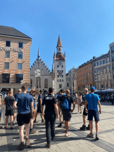
Expedition Route: The trip started in Munich, where we did a walking tour of the city, learning about the city’s history and culture, then caught a train from Munich to Mayrhoffen and, from Mayrhoffen, we got a bus to Finkenberg where we started the ascent to our first hut, Gamshutte. We chose the Hermann-Hecht-Weg way (trail number 533) that crisscrosses through the lavish woodland to Kraxentrager. Eventually, we left the trees and entered the high, completely open universe of the Gamshütte cabin. The climb requires close to three hours to finish and we covered a distance of 6.6km, an elevation gain of 1057.
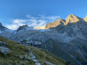
From the Gamshütte hut, situated at a height of 1,921 meters, we moved off early in the morning sun to the Vordere Grinbergspitze (2,687 meters), where the Berlin High Path branches off to the left side – climbing through the tussock slants and rough landscape with dispersed bantam pine fields – while heading to Feldalpe (1,885meters). The smell of the pine fields and Alpine plants is heady and lingers with you long after you’ve headed on. The trail proceeds to Pitzenalm (1,874 meters) and moves to Milchanger in a progression of steep curves. At this altitude, the going is challenging, and the thin air asks much more of your body than at sea level. From Milchanger, we walked through a rough upland level until we arrived at the south shore of the Wesendlekarsee. At this point of the day, the heavy rain set in. The walking was already tough, and the wet weather asked more of us and became an additional challenge. But, knowing that we only had a few hours left, we pushed on following the path towards “Breitlahner – Friesenberghaus”, which took us to Friesenberghaus, stopping at an elevation of 2,477 meters. I think it’s fair to say that we were all happy to enter the warm hut, dry our wet clothes and relax.
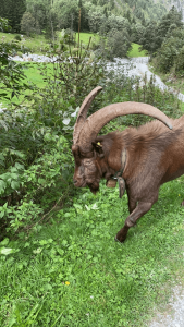
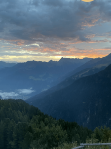
Bright and early, we moved off from the Friesenberghaus hut; the path ascends briefly towards the west before moving in steep bends to a height of 2,602 meters and onto the Friesenbergscharte ridge. From this point, we continued southwards through the rich green fields of Gamsleiten until we arrived at the stupendous Olpererhütte at a height of 2,389 meters. The views at this vantage point are breathtaking and make all the hard work worthwhile. At this point, we decided to stop for lunch and take in the surreal scenery. It’s a precarious plummet from the cabin before the landscape straightens and crosses southwards high over the Riepenbach stream. To the end of the route, the path zigzags down to the Schlegeis reservoir. We followed the path that progressively moves toward the Schlegeiskees glacial mass, and from here, we took the left fork toward the east – climbing up the precarious slant between the Wasserleklamm gorge and the Furtschaglbach stream in curves until we arrived at the Furtschaglhaus hut. By now, we felt like true ‘Mountain Goat Hunters’ after the name of our expedition ‘Bergziege Jäger’.
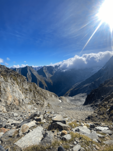
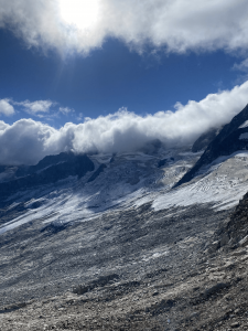
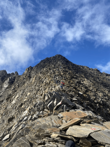
Leaving from the Furtschaglhaus stop, this day journey takes you at first towards the Schönbichler Scharte edge (3,060 meters). It progresses forward with the edge’s south side through a crevasse with permanently fixed cables for security. The altitude at this point was starting to take its toll on all of us. It is a couple of metres’ climb from the east flank to the highest point of the 3,134 meters, the Schönbichlerhorn peak. From that point, the path follows the ridgeline up some stepping stones to a superb trig-point at 2,763 meters. We stopped here to take in the spectacular view of the Berlinerhütte hut. We were following on down the southern side of the ridge, going through the Garberkar Cirque and the northern parallel moraine of Waxeggkees ice sheet. We eventually got to the first river crossing, where we had to improvise and get a few wet feet. From here, we moved forward to where, thankfully, the next river crossing had a bridge. The path climbed consistently over rocks polished and scratched by glacial masses while heading to the Berlinerhütte (2,044 meters). This was tough, and we all had to dig deep to push ourselves on.
From the Berlinerhütte, trail number 502, we navigated the boggy landscape of Schwarzstein moor on the way to the Schwarzsee Lake, situated at a rise of 2,472 meters. At this point, we took the opportunity to have an early morning swim before continuing on the hike. The water was breathtakingly cold but miraculously cured our tired limbs and sore feet. Refreshed and invigorated, we dressed and moved on. After a couple of steep zigzags, we arrived at the Rosskar Cirque and on to the Mörchenscharte edge (2,872 meters). A precarious stone scramble segment (not for the faint-hearted) with fixed cables to assist us along a sheer upward drop took us to Floitengrund and crossed the Floitenbach stream. Following trail number 502, we arrived at the Greizer Hütte (2,227 meters). Departing the Greizer Hütte, we continued on trail number 502 with a gentle climb along stone slabs. At that point, the path then steepened, and we climbed the Lapenscharte ridge, located between the Gigalitzturm rock tower and the Lapenspitze top. From the ridge, it is a one-hour drop to the Grüne-Wand Hütte. The last area, through the Eisenklamm gorge, has fixed cables for assurance, and led us to the Kasseler Hütte. Our last hut on the trail, and by now, the end of our journey was in sight.
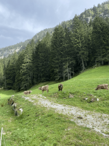
We left the Kasseler hut in good spirits and began our journey back to Mayrhoffen. It was a genuinely simple last day of steady descent down to Mayerhoffen. We proceeded with the lower part of the gorge, through different concrete tunnels andpassed multiple alpine farms. Finally, we descended through a deciduous forest into Mayrhoffen, where a few of us took the opportunity to take the cable car up to take in the view of Mayrhoffen and reflect on the last few days. At this point, we all realised we had more in us than we knew.
Expedition Reflections
Each Officer Cadet (OCdt) had the opportunity to apply and refine the skills they had acquired during the Summer Mountain Foundation course. They did this by takingturns in leadership roles and managing groups of individuals with diverse physicalabilities. This experience encouraged them to work closely as a team, fostering camaraderie and unity among the OCdts.
Participating in Adventure Training proved to be a transformative experience for the OCdts, allowing them to develop and strengthen their leadership and teamwork abilities. This hands-on experience not only broadened their horizons but also served as a valuable tool for personal growth.
For some of the Officer Cadets, this adventure was a gateway to activities they might not have considered attempting on their own. It allowed them to step out of their comfort zones, try new things, and embrace novel challenges. In essence, this journey served as a catalyst for personal development, empowering OCdts to explore their potential in a supportive and encouraging environment. The skills acquired during this expedition have equipped them with not only the knowledge but also the confidence to engage in various outdoor activities. Whether it’s hiking, camping, or even the ambitious task of planning their own expeditions, they now possess the necessary expertise to do so. These newfound skills are not just confined to the expedition but extend to various aspects of their personal and professional lives, making them more adaptable and resourceful individuals.
Quotes
“It was a great experience, as I’d never been to Austria. the views were amazing, and there was a lot of time to build up teamwork between us.”
“We had loads of fun, for someone who has not travelled much all the different transport was really fun. Then we got to the mountains, which were stunning, and each Hut perched with superb views across the valleys. We even got to know some of the people following our route.”
“The walking was really tough, but my friends made it better, and I learnt a lot about navigating in the mountains, which is much harder. I’m already planning a family trip just because I want to go back.”

